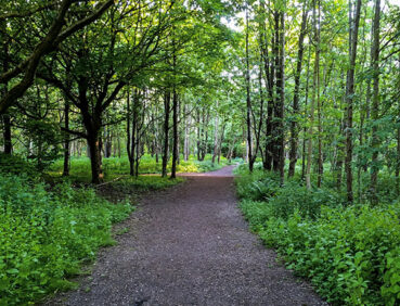
The second stage of the GM Ringway walking trail follows a series of tranquil, traffic-free footpaths through the Mersey Valley greenbelt of South Manchester.
Please note that, as of early 2025, Bailey’s Bridge near Chorlton remains closed. In addition, there are several new path closures due to flooding on the second half of the route, which should be avoided for the time being. See ‘Detours and trail updates’ below. We will issue a further update when the paths are reopened.
Highlights include:
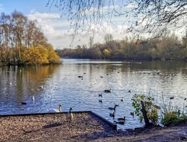
- The wildlife and greenery of Chorlton Water Park
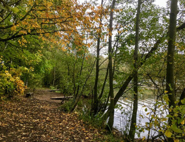
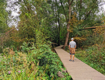
- The trees and birdlife of Kenworthy Woods
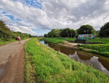
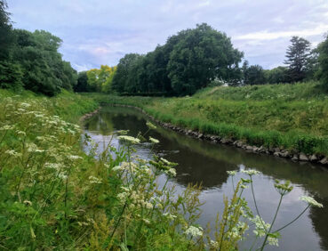
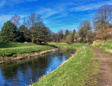
- An especially pretty meander of the River Mersey
- An old country lane near Didsbury village
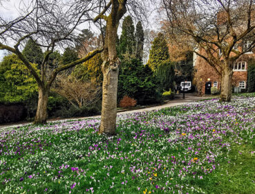
- Fletcher Moss, one of the most attractive and varied areas of parkland in Manchester.
Note that parts of the trail may be damp, muddy and slippery at any time of year and especially after periods of wet weather. Please bear this in mind when planning your trip.
Be sure to keep your dog on its lead in sensitive areas, which include upland areas such as moorland, wetlands and mosslands, farmland, and parkland. Keeping dogs on leads helps protect both livestock and wildlife, especially ground-nesting birds.
This walk is available on the user-friendly Go Jauntly walking app. Here, photographs and written directions will enable you to follow the route on your phone. You can also download a printable PDF of the directions from the same link.
Alternatively, you can follow the route (without written directions) on the mobile-friendly Plotaroute site. To use Plotaroute on your phone’s browser, simply click the map. Then, when you’re ready to start walking, click the tracker icon (bottom right) to show your position as you follow the route.
We recommend carrying an additional power source and/or map when following online routes on your phone. For any challenging routes, we would recommend that you also have access to and know how to read an Ordnance Survey map.
The overall route is very level, with no steep gradients encountered. While most of the paths used are wide and well-made, they can be uneven and potholed in places. Mud and puddles are likely on certain sections. The ‘Detours and trail updates’ section below also describes some diversions and an exit route in the event of flooding.
The paths and terrain encountered on this walk are shown and described in more detail on the Go Jauntly version of the walk, enabling you to make your own assessment of whether the route is accessible for you.
However, the varied terrain involved in this route means that the overall route is not suitable for wheelchairs or pushchairs. Please visit our Shorter walks page for a selection of step-free walks on the GM Ringway trail.
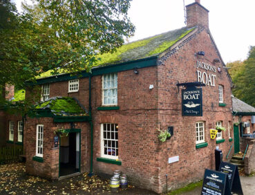
Public toilets are available – to the best of our knowledge – near the start in Sale Water Park. Along the way, toilets can be found near the car park for Chorlton Water Park (accessed by a sloping path) and in Fletcher Moss Park near the end of the route. In addition, the Treetops café and Jackson’s Boat pub are close to the start point. En route, you will often find a coffee van or an ice cream van parked near the lake in Chorlton Water Park. Towards the finish point, there are cafés in Fletcher Moss Park and Didsbury Park, as well as several pubs and cafes in Didsbury Village.
There are children’s play facilities in Chorlton Water Park and in Fletcher Moss and Didsbury parks, making this an especially suitable walk for families.
As the GM Ringway is designed around the tram, train and bus network, we recommend the use of public transport to access the start and end points. However, we also provide tips for drivers below.
Start and end points
To work out how to get to and from the walk start end points, simply click the links below to see the location in Google Maps. Then click ‘Directions’ and enter your starting location or destination. For public transport options, click the train icon.
Start point: Sale Water Park tram stop M33 2LX
End point: Didsbury Village tram stop M20 6WE
Public transport
This trail stage connects with Sale Water Park tram station, on the city centre-to-airport Metrolink line, with Didsbury Village tram station on the East Didsbury Line. Some walkers might find it easier to return home by train from the nearby East Didsbury train station, or take a bus from Didsbury village. Train times can be checked by visiting the National Rail website, while details of bus and tram services can be found on the TfGM journey planner.
Recommended tickets
If you are travelling only by tram, you will need a Metrolink ticket to cover the zones you travel through. You can check the price of these on the Bee Network website and then purchase your ticket from the machine at the stop or tap in and out with your bank card.
If you are travelling by a mix of buses, trains or trams, then a combined day ticket might be cheaper. Check the TfGM Tickets and passes page to find the best option (selecting ‘1 day and return’ as your answer to ‘How often would you be travelling?’).
Parking
Drivers are advised to park at Sale Water Park Metrolink Park & Ride, where there is parking for 285 cars and 16 disabled spaces. They can return to their car at the end of the walk by taking a tram from Didsbury Village towards Manchester and changing onto a Manchester Airport tram at St Werburghs Road tram stop (total journey time approx. 20 minutes).
Cut-off points
If, for example, you only want to walk a section of the stage, there are several locations where public transport can be used to leave or to access the route. The most straightforward option, close to the half-way point, involves walking up Darley Avenue or Stanton Avenue to Barlow Moor Road in West Didsbury, from where buses return to Chorlton or continue to Didsbury. For details see the Plotaroute map.
Two diversions are shown on the Plotaroute map. These should be used from January 2025 until further notice, pending repair of the bridge and damaged paths within the Mersey flood basin.
The first diversion shows the route to be taken during the long-term closure (2024-25) of Bailey’s Bridge, which crosses the Mersey to Kenworthy Woods.
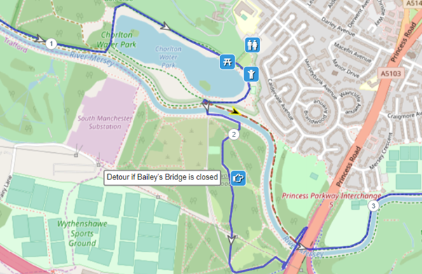
The second diversion requires you to exit the main route near West Didsbury because of several path closures, due to flooding, from January 2025 until further notice. As the map shows, Darley Avenue can be followed to the main Barlow Moor Road. From here, you can either take a regular bus back to Chorlton (near the start point) or to the end at Didsbury Village. Alternatively you can follow Barlow Moor Road to Didsbury.

To give any feedback or notify us of any issues with this route, please complete this form.